|
||||
| ქართული ვერსია |
|
|||
 |
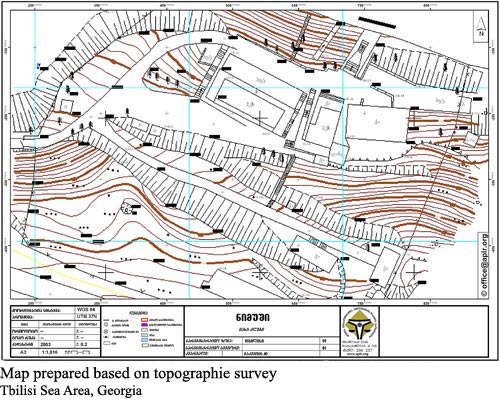
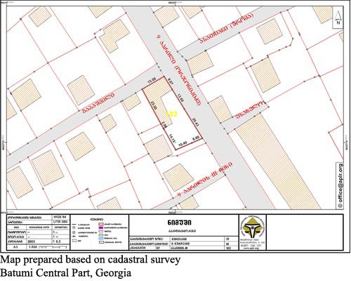
Topographic/Cadastral SurveysAPLR offers its clients high precision survey services and after processing the field data prepares cadastral/topographic maps using modern geodetic equipment. Based on these surveys the customer can specify land parcel boundaries and area and officially register his/her ownership rights to land/real property at the Public Registry. APLR carries out topographic survey, cadastral survey and demarcation of the selected area in accordance with the client’s requirements. Topographic survey aims at depicting the shape of the land area on the map. APLR specialists survey the roads, parcels, communications, rivers, ravines, surface elevations and other details according to the requested specifications and depict the field data on topographic maps after processing.
Through cadastral survey and demarcation the borders of the parcel and adjoining areas are specified. In case of land parcel division or disputed border APLR surveyors help the clients to determine the parcel boundaries.
For conducting the field works APLR uses high-precision survey equipment. The field data are processed by qualified specialists with modern GIS software. The fees for cadastral/topographic surveys are based in accordance with the scope of work, upon agreement with the client.
|
|||
|
APLR Head Office in Tbilisi Copyright © 2006, Association of Professionals on Land and Realty |
||||