|
||||
| ქართული ვერსია |
|
|||
 |
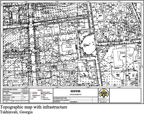
Preparation of Cadastral, Topographic and Thematic MapsAPLR ensures preparing topographic, cadastral and thematic maps for any territory of Georgia in accordance with requested specifications via its central and regional offices. The clients can get both printed and electronic versions of these maps. Topographic map depicts the shape of the area, such as rivers, ravines, topographic elevations and other details. Cadastral information (the boarders of the parcels) may also be depicted on topographic map.
Taking into account clients requirements, information on infrastructure, such as ways, aerial cables, contact system masts, railways, bridges, tunnels, wells etc. are often depicted on the topographic map.
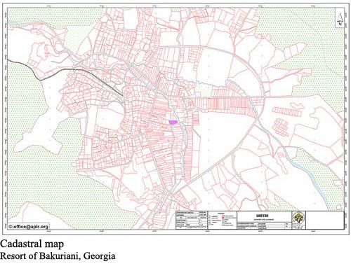
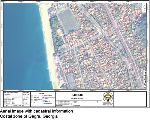
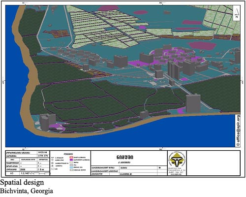
Cadastral map shows precise borders of the land parcel and adjoining areas/facilities. Cadastral maps are prepared based on field surveys and using aerial/satellite images. Aerial/satellite images with cadastral information depict the precise borders of the land parcels and adjoining territories. The clients can also get a special service that implies designing the plan for the requested area, preparing thematic map, spatial design etc. by the qualified specialist.
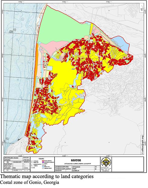
Through the thematic map it is possible to separate agricultural and non-agricultural, state-owned and private land parcels, forests, rivers and any other objects, indicate percentage of particular areas according to various parameters, or depict various information according to the client’ requirements.
Spatial design helps the customers to visualize any interesting area or facility.
Fees for above services are based in accordance with the scope of work, upon agreement with the client.
|
|||
|
APLR Head Office in Tbilisi Copyright © 2006, Association of Professionals on Land and Realty |
||||